

Aerial patrolling software & services
Know what needs attention across your network.
For pipelines, electrical transmission lines, and fibre optic routes. Sunstone plans the flights, collects the data, and delivers mapped findings and inspection reports.
Your team shouldn’t have to piece the inspection together.
Keep each finding connected to its location, supporting imagery, and survey record. Give your team the context to decide what comes next.
One inspection. A clear record.
See the finding. Understand the location. Review the supporting evidence.
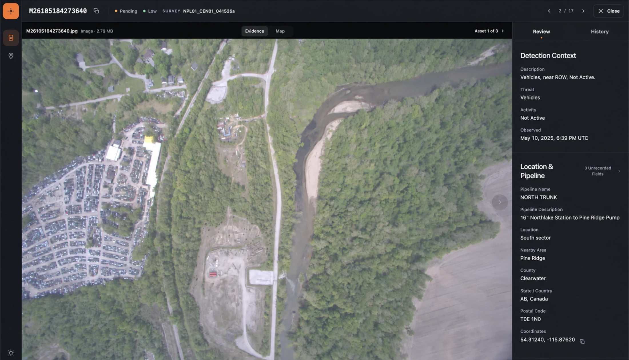
Records you can put on the map Explore the survey area and open nearby inspection records with their location in view.
Reports you can review Find the inspection record, check its review status, and open the supporting details.
Deliverables are agreed around your inspection scope. Select any screenshot for a closer look.
From a point on the map to the full picture.
Open an inspection record and review the imagery, observation, and location together. See the context behind the finding.
From planning the flight to keeping the record.
Plan routes. Coordinate crews. Collect and process data. Create reports. Explore the tools behind each part of the inspection.
PATH · Desktop route planning
PATH
Build the flight plan.
Turn your asset data into an optimized survey route. Review airspace, terrain, obstacles, and reporting requirements before the flight.
SCHEDULE
Get the crew and aircraft ready.
Coordinate survey dates, personnel, qualifications, and aircraft availability. Bring maintenance requirements into the scheduling decision.
FLIGHT · Crew and administrator displays
FLIGHT
Follow the route. Collect the data.
Give pilots and operators the navigation, sensor controls, and survey information they need during the flight.
FORMS
Keep the field record up to date.
Record fuel, expenses, survey activity, maintenance notes, and logbook entries from the field. Feed those records into SCHEDULE.
FOLLOWING
See the survey progress.
Track the aircraft position and progress in near real time while the survey is underway.
PROCESS · Desktop processing workspace
PROCESS
Make the data ready for review.
Turn raw flight data into imagery linked to its location and coverage maps, so analysts can review the survey and check what was covered.
WORLDFILES
Use the imagery in your own maps.
Create Esri world files that place survey imagery in the right location in your geographic information system (GIS).
REPORT · Desktop report creation
REPORT
Turn an observation into a report.
Review imagery, annotate findings, and generate reports with their location, distance from the asset, and relevant client details.
DATABASE
Keep the complete survey history.
Search surveys and reports, review imagery and coverage, and add notes or supporting records for future follow-up.
An inspection delivered. Or software for your crew.
Get the survey and reports your team needs, or run the Sunstone software with your own operation.
For infrastructure operators
Put the inspection in our hands.
Sunstone plans your survey, coordinates flying through its flight partner, processes the data and delivers mapped findings and inspection reports.
For aerial service providers
Your aircraft. Your crews. Our software.
License the tools to plan surveys, coordinate crews, collect data, produce reports and manage inspection records.
A few useful starting points.
What should we bring to the first conversation?
Tell us whether you operate pipelines, electrical transmission lines, or fibre optic routes. Bring the area you need inspected, your current process, and what your team needs to learn from the survey.
Can we use the software with our own crew?
The software licensing option is intended for aerial service providers. We would discuss your aircraft, equipment, workflow, and reporting needs to establish whether it fits your operation.
What is included in an inspection?
The scope is agreed before scheduling. Findings, imagery, coverage records, and report formats depend on the inspection requirements and the data collected.
Tell us what you need to inspect.
Discuss your assets, current process, and inspection scope.